The old adage, "An ounce of prevention is worth a pound of cure" is a wise saying that has always been true in my experiences. When trip planning, I'm tempted to get the truck in motion toward the destination immediately and worry about the details later. However, it has always paid off for me to do a little "map reconnaissance" before leaving my origin. While stopped in traffic on I-495 (a daily occurrence as many of you know) I happened to look over and see one of the Google camera vehicles whose job is to ride over every road in America and video map it.
_1.JPG) I use the map app called "MobiMaps" to augment my GPS.
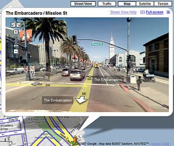
I use the map app called "MobiMaps" to augment my GPS. They use the latest editions of Google mapping which is important with all the new construction going on. I really appreciate their work, as the
street view really makes our job easier. For instance, you can't judge the elevation changes from a traditional bird's eye view. That can be very important when you're pulling a low clearance vehicle that can get stuck on an entrance or railroad crossing that most van and flatbed truckers wouldn't give a second thought. I've even used it to check out posted overpass clearance signs that I'm unsure about on my route. With the street view I can look at the actual sign that I will encounter later when I actually drive the route, but it's helpful to know in advance. It can also be used to choose the best entrance to the shipper or receiver. Sometimes you can find the signs that say "truck entrance" while using the street view function of Google maps.
Driving 75' vehicles in large metropolitan areas is a challenge even for the most seasoned veteran. Not all of us have dedicated routes and customers and encounter new shippers and receivers everyday. Let's use technology to our advantage so we don't get ourselves in a situation that we don't want to be in.